Last Updated on February 28, 2024 by James Dziezynski

Panorama of Mount Sanitas as seen from the Anemone Trail.
Boulder’s access to a wealth of fantastic hiking makes it one of the most foot-traffic friendly cities in Colorado. The marquee trails tend to be lively, well-traveled places but rest assured there are low-key enclaves where you can break away from the crowds and explore peaceful pockets in the foothills. These trails are less traveled with good wildlife potential and easy to reach trailheads.
Anemone Trail
The Anemone Trail is hiding in plain sight but tends to get overlooked as it shares a parking lot with the wildly popular Mount Sanitas. The easily accessed Red Rocks formation just prior to the Anemone Trail cutoff siphons away yet more hikers but don’t get distracted! Some of Boulder’s best views await on this 3 mile out and back trail. The nameless 6,423 ft. peak that the trail ascends splits Boulder Canyon to the south and Sunshine Canyon to the north, offering fantastic vistas of both. Wide open views to the west gaze upon the 13,000 ft. mountains of the Indian Peaks while several unobstructed viewpoints present an expansive horizon of the eastern plains. On a clear day you can see Denver and Pikes Peak. Not only is it aesthetically pleasing, you’ll get a good workout with 1,040 ft. of elevation gain. There are a few steep sections but the trail is easy to follow and well maintained.
Directions: Centennial Park Trailhead is 0.3 miles west of the intersection of Mapleton Avenue and 4th Street along Mapleton Avenue (which turns into Sunshine Canyon). The large trailhead is well marked on the south side of the road and accommodates 25 vehicles. Follow the trail directly from the parking lot to the south and turn right (west) to the Anemone Trail across from Red Rocks 0.2 miles up.

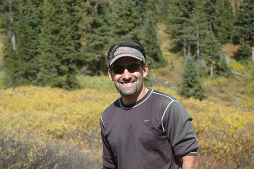
Fremont on the summit of the Anemone Trail.
Shadow Canyon Ridge
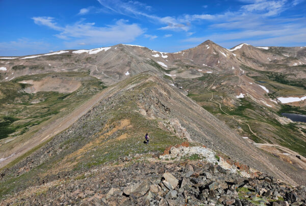
This unassuming spur off the popular Shadow Canyon Trail in South Boulder is like stepping into a secret garden. Depending on how you access the Shadow Canyon Trail (usually from the Shadow Canyon/South Mesa Trail parking area near Eldorado Springs), this hike is about 4.5 – 5 miles total and there is the option to make a nice loop using the Homestead and Mesa Trails. At a corner along the Shadow Canyon Trail shortly after the Mesa/Shadow split, there is an easy-to-miss open space marker designating a seldom used trail that terminates on a side road in the town of Eldorado Springs. Open meadow views here are amazing, including a great perspective of Devil’s Thumb. A short .3 miles on a faint trail to southeast leads to this scenic 6,584 ft. ridge featuring the “micro-Flatirons”. If you’re good at tracking , a barely-there climber’s trail goes 0.4 miles off the east of the peak and reconnects with the Homestead Trail for a nice loop that cuts off a little bit of the return journey.
Directions: From the intersection of CO 93 (South Broadway) and CO 170 (Eldorado Springs), turn west onto CO 170 and follow this road 1.8 miles to the South Mesa Trail parking area on the north (right) side of the road. From the trailhead, follow either the Mesa Trail to the Shadow Canyon Trail or the Homestead Trail to Shadow Canyon and find the aforementioned turnoff along the Shadow Canyon Trail about 5 minutes beyond as it begins to ascend South Boulder Peak. Note there is some trail reconstruction going on here along the Homestead Trail but the trails are well marked.

The sign designating the “secret” way to Shadow Canyon Ridge.

A nice open meadow along the way, with Devil’s Thumb off to the right.

Fremont peruses the micro-Flatirons.
Annie U. White Trail
This short out and back trail (2.4 miles round trip) is a departure from the dusty, rugged mountain trails Boulder is known for. An easy, wooded trail is surprisingly lush as it gently winds next to Four Mile Creek. Quiet, shady and peaceful, it’s a great place to beat the heat in the summer and enjoy pristine snowfall in the winter. A modest elevation gain of about 400 ft. is nearly unnoticeable and adventurous rock climbers can seek secret outcrops that are great for bouldering. It’s worth noticing that there are only three parking spots at the trailhead – technically seven, but for some odd reason four spots are cordoned off for “emergency vehicles”. If the place is “packed” park down the road on Wagon Wheel Gap Road and make the short walk to the trailhead.
Directions: From north Boulder, turn west onto Lee Hill Drive from Broadway. Follow Lee Hill 1.1 miles and turn left onto Wagon Wheel Gap Road. Follow Wagon Wheel Gap Road 1 mile to a left turn onto Pinto Drive, a brief dirt road that ends at the Annie U. White Trailhead.

The start of the Annie U. White trail.
Olde Stage Open Space (Buckingham Park)
You may have passed by the last secret spot while screaming down Olde Stage Road on your roadbike. Heading north along a bend in the road just before Olde Stage connects with Left Hand Canyon, there is a small pullout parking area with an open space marker. Here you’ll find a pleasant 1.1 mile trail (2.2 miles round trip as an out and back) that goes into Buckingham Park “valley”. Note that you may have seen the Buckingham Park parking area along Left Hand Canyon – this is not the same area, this parking is off of Olde Stage. This quiet trail is chock full of flowers and colorful grasses and a short but fun scramble brings you up to the high cliffs on the east side of Left Hand Canyon. There are great views and bald eagles are often spotted soaring through the sky.
Directions: At the north end of Olde Stage Road there is a small turn off. This parking area is 0.2 miles south of where Left Hand Canyon and Olde Stage merge. The trail is easy to spot to the north of this little pullout.

Here’s the parking area off Olde Stage for Buckingham Park.

A lovely romp and big sky at Buckingham Park.