Last Updated on June 8, 2014 by James Dziezynski
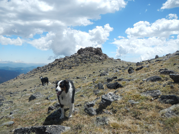
The crowning summit of 12,386 ft. Republican Mountain.
Ever since Fremont and I climbed Bard Peak as part of our Watrous Gulch adventure, I’ve had my eye on seldom-visited Republican Mountain. Republican is one of a trio of lower elevation summits southeast from the small town of Empire, Colorado (the others being 12,287 ft. Sherman Mountain and 12,477 ft. Silver Plume Mountain). There wasn’t much information on hiking this peak, which meant it was either a lousy summit or people just didn’t go there.
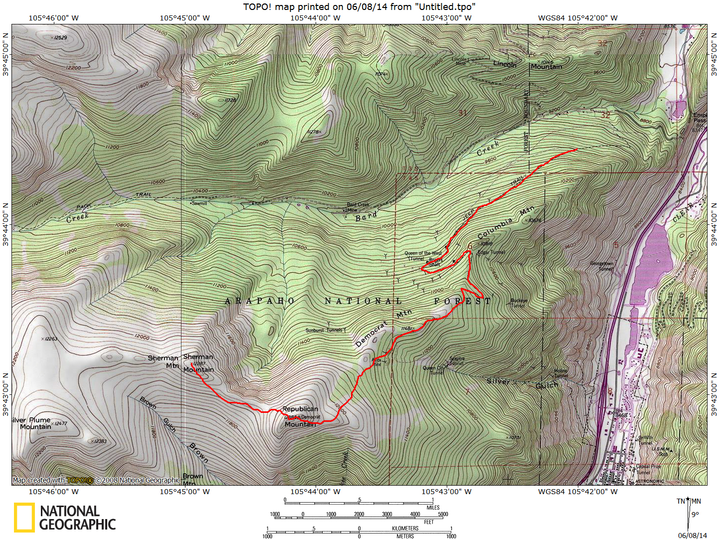
Click for full sized map.
Luckily, it turns out Republican is a fine hike and a worthy “secret” summit. The approach in this trip report is from from the northeast, though it looks like there’s a viable route to the mountain via the south slopes of Brown Gulch from the 7:30 Mine Trail out of the town of Silver Plume. I hope to visit this option later this year (which may also be a nice option for snagging Bard Peak).
Directions & Driving: Take exit 232 off of I-70 towards the town of Empire. This exit is roughly an hour’s drive from the Denver/Boulder area. Follow Hwy. 40 a few minutes to Empire and once in town, take a left (south) turn onto South Main Street. If you have eagle eyes, you can see the words “Bard Creek” in super-tiny font on the street sign. South Main turns into Bard Creek Road. From the turn at Hwy 40 and S. Main it is 1.1 miles to a small community and lake on the west ride of the road. From here, the road starts to get rougher. Lower clearance cars may want to take it easy here, though there’s only one semi-tricky rocky hill before the turnoff towards Republican Mountain.
At mile 2.1, a well-signed turnoff to the left (south) appears for Democrat and Republican Mountains. If you have a less-rugged SUV or Subaru Outback-type vehicle, you may want to park down here. The 4×4 road that follows requires high clearance as there are lots of rock outcrops. The hills are also steep enough that you’ll likely have to shift into 4-low to climb them. Along the entire road, there are many places to pull off and park. I was able to get my 4-Runner a bumpy 0.7 miles up from the start of this road before I decided to park.. That being said, I think I *could* have gone higher without too much trouble. Jeeps and other tough SUVs (with good tires!) can likely crawl up the entire 3.8 miles of the road, which cuts off a little time and distance and starts you at the top of so-called “Democrat Mountain”, which is really just a shoulder point on Republican Mountain. This write up starts from my parking area at 9,570 ft. 0.7 miles up the Democrat/Republican 4×4 road.
Note: From the intersection of Bard Creek Road and the Democrat/Republican turnoff, it is 4.8 miles to the summit of Republican Mountain. Those with cars will likely have to park there and hoof it. For you 4×4 enthusiasts, check out the write up for Republican/Democrat Road courtesy of traildamage.com.
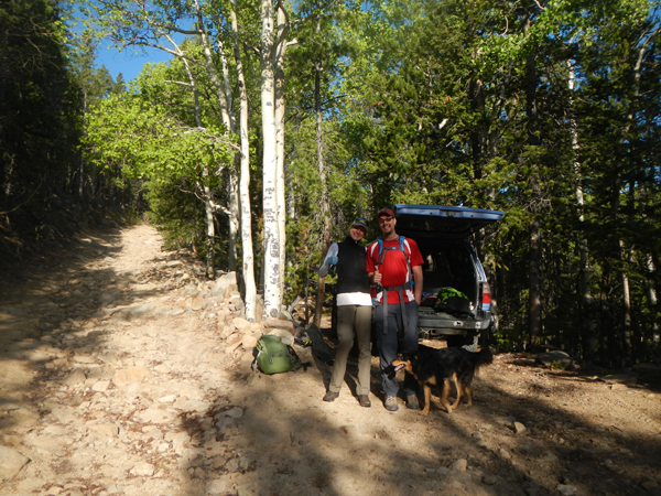
Jenny, Paul and Mystic at our parking spot along the 4×4 road to Democrat/Republican.
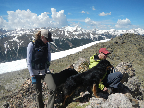
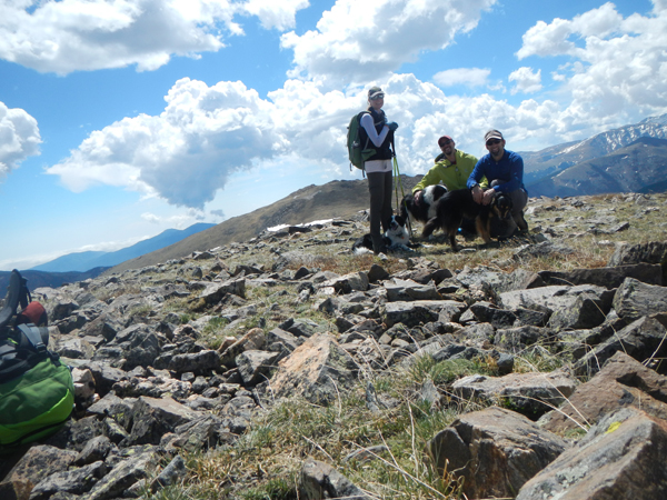
The Hike: I was lucky enough to have Jenny and Paul along for this adventure, plus my border collies Mystic and Fremont and Jenny’s pup Clyde. After we parked, the hike towards Republican Mountain began on the 4×4 road. There are dozens of old mine ruins along the way and the tall pines offer some nice morning shade. We hiked in early June and didn’t see any other vehicles. The road trends west and south. At mile 2.5, there’s an impressive viewpoint/pullout that overlooks the Bard Creek drainage. Note there are a few spur roads along the way; stay the course on the main road. There is one “Y” split about 2.8 miles where the left trail goes to old mine ruins and the right trail goes up a steep hill — the right fork is the correct one. It had a little cairn when we were there.
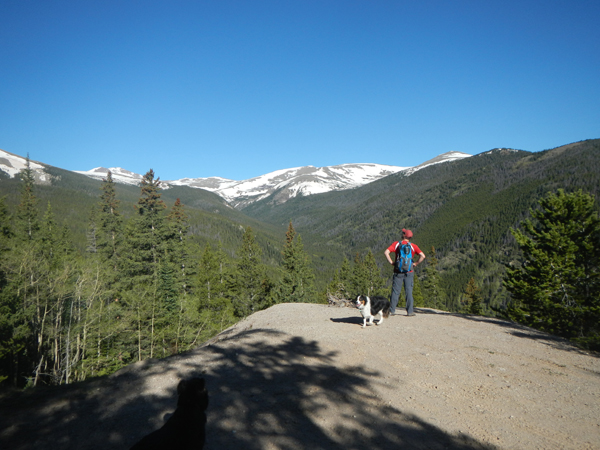
Paul and Fremont take in the dramatic overlook views!
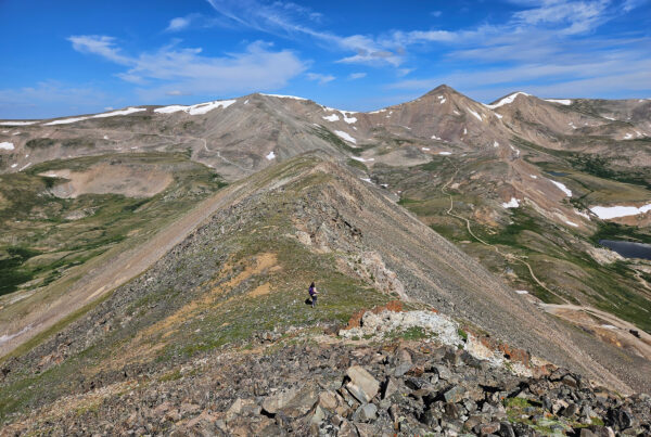
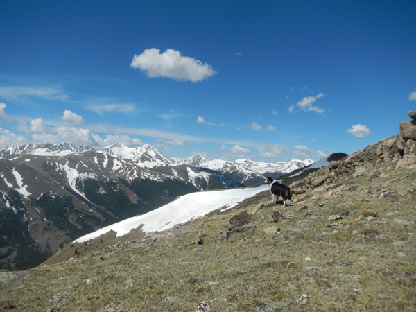
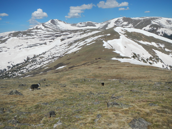
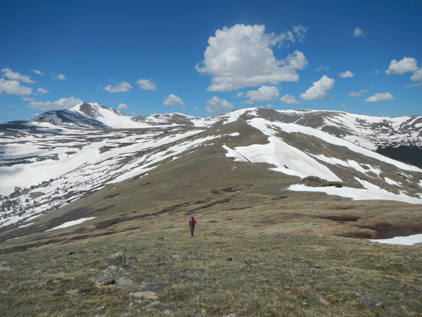
3.4 miles along the road, you’ll be on the cusp of treeline and finally see Republican Mountain looming to the west. If there’s snow, you’ll likely lose the road but no worries — stay on the ridge along the high point, keeping a bearing on Republican Mountain. You’ll be easily able to visually stay on track in good weather. This flat, open shoulder is Democrat Mountain, which isn’t so much a mountain as it is a point on the side of Republican. This section looks great for camping!
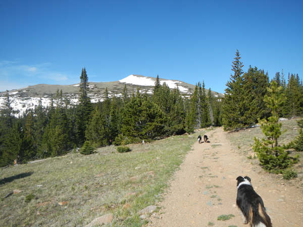
Republican Mountain in sight!
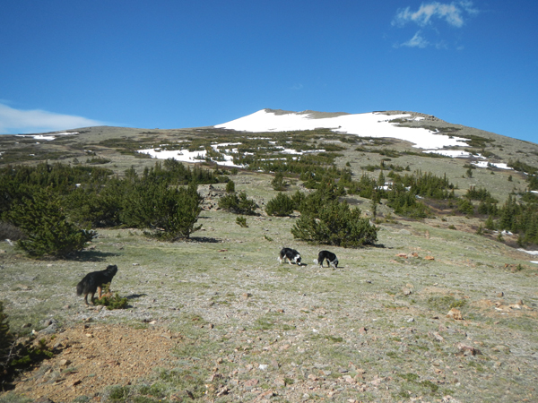
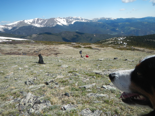
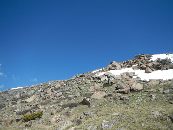
Passing a few more mine ruins, the road finally ends just past this section. There is a faint 4×4/hiking trail that continues on the best line southwest. A few small pools of water here offered refreshment for the dogs! As we emerged from treeline, we were treated to fantastic views of Grays and Torreys Peaks — along with Grizzly Peak, Mount Wilcox, “Cupid” Peak and Mount Edwards. The modest slope here leads to another flat shoulder with some interesting crowns of rock.
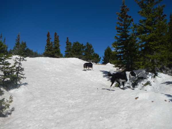
Snow overtook the 4×4 road near the top, but it was still easy to follow.
Past the snow. Good camping possibilities!
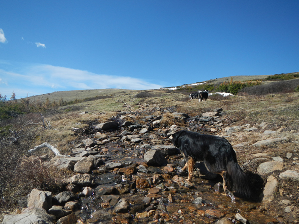
A stream en route to the peak.
A quick rest before going for the summit!
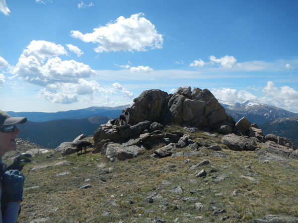
One of the “crowns” on the shoulder of Republican Mountain.
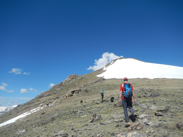
Closing in…
A look back at the “crowns”.
What views!
Jenny & the pups.
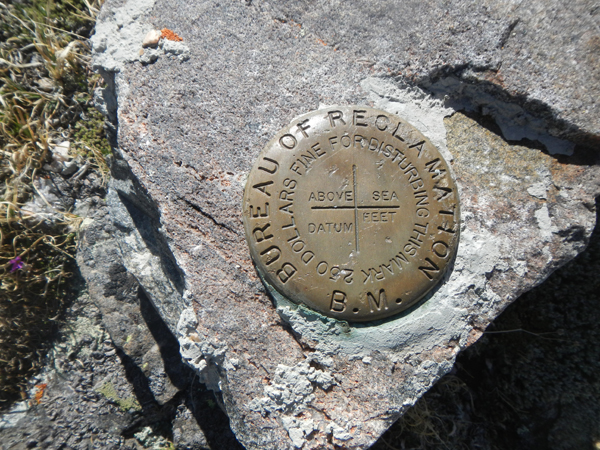
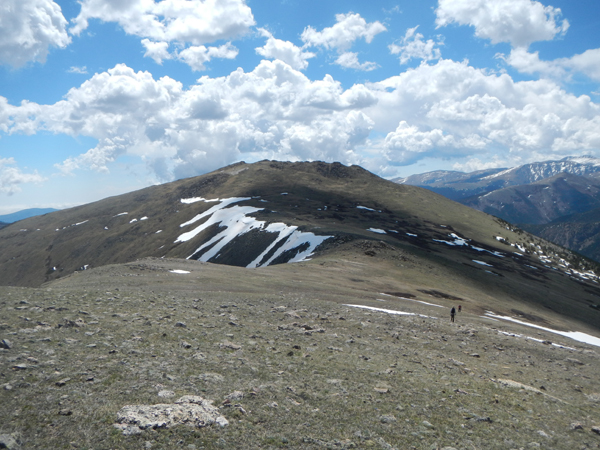
At mile 4.1, we made the summit of Republican Mountain, itself the largest “crown” of all the rock outcrops. It’s an easy scramble to the highest point and there’s some old wire and debris intertwined in the summit stones. We did find a USGS marker just north of the summit that was oddly embedded in a football sized rock. Perhaps it was moved from the summit? Either way, the eastern summit is the higher of the two, though it’s an easy walk to the western “summit”.
On the summit of Republican Mountain!
The summit-ish marker.
Fremont looks out on peaks he’s already visited!
The pups lead the way to Sherman Mountain. Note the steep headwall to the right.
Paul and Jenny close in on Sherman.
Sherman summit!
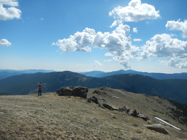
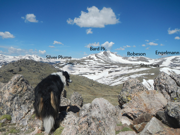
From here, the huge peak to the west it 13,641 ft. Bard Peak. Scanning the horizon north of Bard is 13,140 ft. Robeson Peak and 13,352 ft. Engelmann Peak. Closer by is the humble 12,287 ft. summit of Sherman Mountain, a nice 0.8 walk from the top of Republican. It took us about 15 minutes to hike over to Sherman. You may see on the map that my GPS tracks stayed left (west) of the main ridge. This is because the saddle has a rather steep headwall to the northeast and I didn’t want my snow-loving pups to take a slide down! Staying on the high ridge is perfectly fine.
Paul on the way back to Republican.
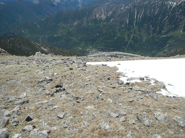
I-70 and the town of Silver Plume.
From Sherman, it’s almost a flat walk 1.16 miles to Silver Plume Mountain, only gaining about 200 vertical feet. The weather was starting close in on us, we opted to retrace our tracks. However, a look at the Brown Gulch from the town of Silver Plume revealed a possible route up here… so stay tuned!
Click for goofy panorama!
Return the way you came. It’s neat to get a glimpse down to the town of Silver Plume and I-70 as you descend south off of Republican Mountain Once we got back to the truck, the 4×4 road was a little easier to descend than to climb, though a few shelf-y sections were rather exciting!
Conclusion: I was really impressed with Republican Mountain, it was a much more scenic and enjoyable hike than I had anticipated. Some people might not love hiking the 4×4 road but it’s really more like a wide hiking trail. The open landscape and wandering potential of this area is fantastic! A strong hiker could tack on additional big peaks; camping on Democrat Mountain and going to Bard Peak (and maybe more) may be a really cool weekend overnight!
There was no summit register on either peak, though Sherman had a tiny wind shelter near the summit. I’m looking forward to hitting up the 7:30 Mine Trail out of Silver Plume later this season and seeing how the Brown Gulch option compares. I’m guessing I’ll aim for Silver Plume and Bard Peak.
Now, allow me to pat myself on the back for refraining from making any snarky political jokes for this entire trip report!