Last Updated on October 21, 2013 by James Dziezynski
Editor’s note: I’ve done my best to avoid every corny “whale” pun I could think of. I hope you find the pictures ok, I’d hate to have to hump back up there in these conditions.
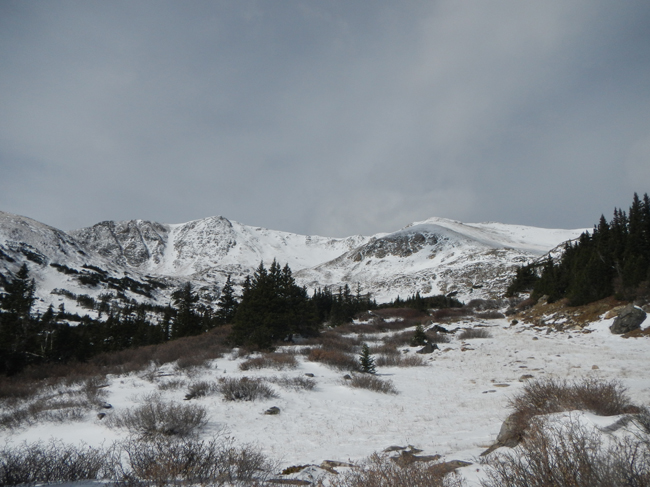
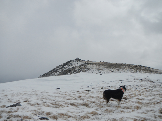
13,078 ft. Whale Peak is the high bump to the right of the snowed in gully.
Summit Elevation: 13,078 ft.
Round Trip Distance: 6.8 miles (Gibson Lake trailhead route)
Difficulty: Moderate. Off-trail hiking with a few steep, non-exposed sections
Hiking Time: 5 – 7 hours
Directions: Take U.S. 285 to Park County Road 60 (Hall Valley Road). This turn off is 4.3 miles north of Kenosha Pass and 3 miles south from center of the modest town of Grant. Turn onto Park County Road 60 and follow this maintained dirt road 5.2 miles. Along the way you will pass Handcart Campground on your left. Go past it to a signed intersection at mile 5.2 and turn left towards Hall Valley Campground/Gibson Lake on FSR 120.B. Passenger vehicles will have to park here. From this point, it is 1.2 miles to the Gibson Lake Trailhead. Note that Hall Valley Campground is only a few hundred feet from this juncture.
4x4s and high-clearance vehicles can take a right (westerly) turn onto FSR 120.C just before the campground proper. This 4×4 road goes 1.2 miles to the Gibson Lake trailhead. It’s a rocky road with a few spots requiring high clearance, but not very difficult by Colorado standards. Sport-utility cars like Subaru Outbacks may have issues clearing some of the bigger rocks. There is a stream crossing 0.2 miles in. Go one more mile and the small parking area (4 -5 vehicles) will be marked on the left hand side of the road. The Gibson Lake trail starts here.
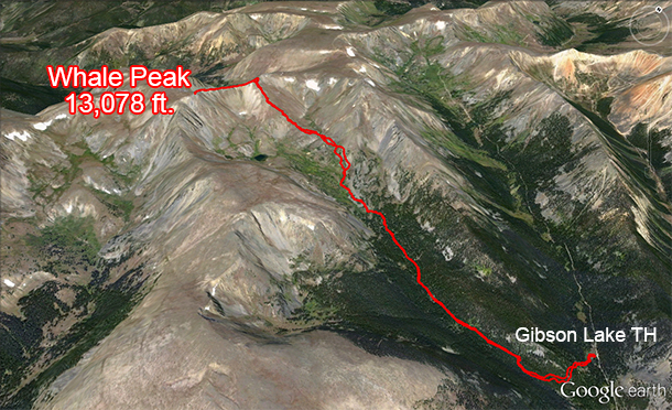
Gibson Lake route to Whale Peak ala Google Earth.
13,078 ft. Whale Peak is a hidden gem tucked away in the southern Front Range. Several mountains in this area bear the scars of heavy mining activity but this southeasterly approach to Whale Peak is exempt from major damage and decrepit mining ruins that pollute some of the neighboring peaks.
Whale can be accessed from the north or the southeast. The northern routes are scratched up with old mining and 4×4 roads while the southeastern approaches are much more pristine. Thus, we decided to start from the Gibson Lake Trailhead and indulge in the undeveloped wilderness. The drive up to the trailhead is relatively close to the Denver/Boulder metro area, about a 2 hour journey that avoids I-70. The turn off to Gibson Lake is in the town of Grant off Hwy 285 south. Passenger cars can easily make it along a maintained dirt road to Hall Valley Campground, where they will have to park and hoof it 1.2 miles to the small but marked Gibson Lake trailhead. High clearance vehicles and 4x4s can drive this moderately rocky stretch without too much trouble.
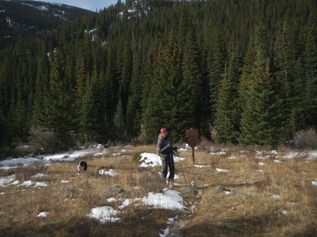
Gibson Lake Trailhead, where the adventure begins.
Because we were hiking during the shoulder season in mid-October, we didn’t see any other hikers along the trail. The snow and ice on the peak added an expected degree of difficulty. I hadn’t really thought out my gear and was a little under dressed for the occasion. A pair of hiking poles is highly recommended, as there is no established trail to the summit. I also should have worn gaiters, boots (rather than my low hikers) and brought along a balaclava. That’s what happens when you transition from summer to winter with no autumn!
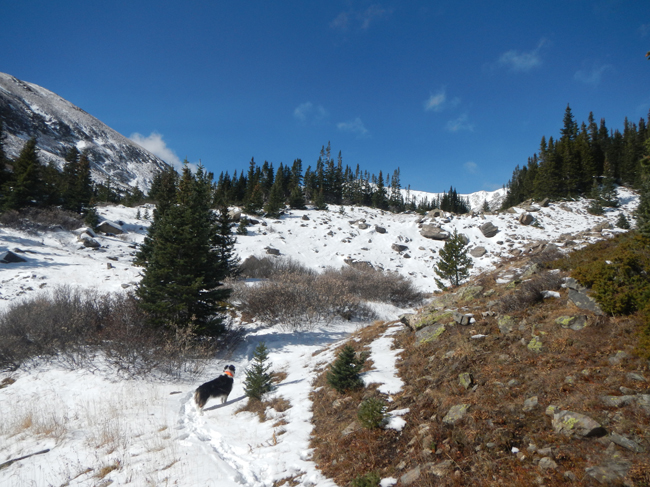
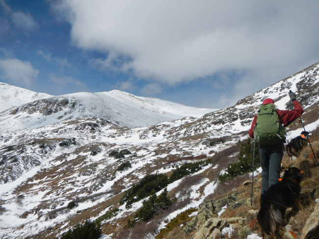
Fremont breaks through treeline en route to Whale Peak.
The Gibson Lake trail offers a peaceful, shady climb accented by a gentle creek. As we breached treeline at 1.9 miles, we left the established trail (before reaching the lake) and set off for the inviting shoulder of Whale Peak to the north. In the summer, following this trail to Gibson Lake and ascending via the east slopes of Whale makes perfect sense but with the snow cover, our detour saved us a little bit of tedious tromping.
After some wobbly off camber hiking, we gained the connecting ridge without any trouble. The line up to the main summit ridge is fairly obvious and the terrain was non-technical without exposure. It was steep at times, especially in the mini-saddles where snow had accumulated in deep drifts. Luckily, these drifted over sections were short lived.
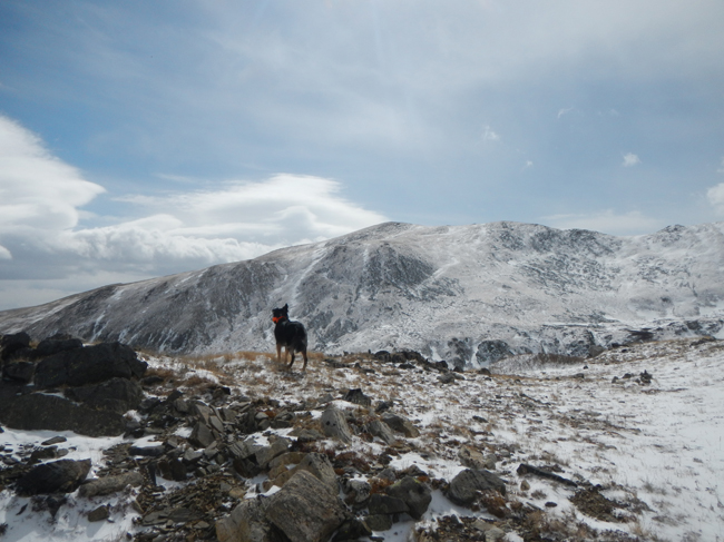
We left the Gibson Lake Trail and opted to bushwack up Whale Peak’s big, north shoulder.
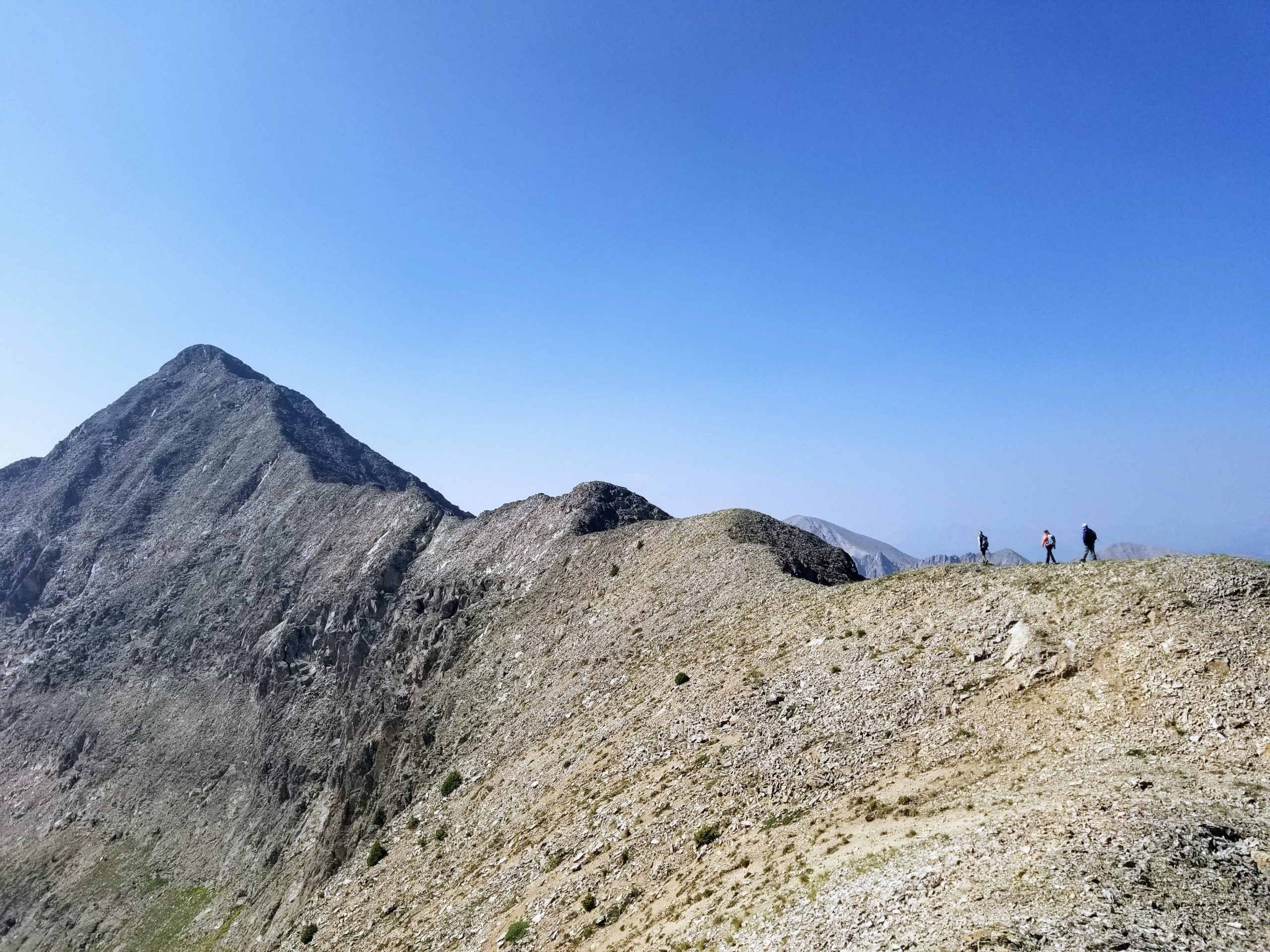
At 3 miles, we were at the 12,890 ft. high junction between our goal and an unnamed sub-peak. A 0.4 mile hike along a beautiful rolling ridge would bring us to the summit of Whale Peak, now looming to the south. Building to the west, however, was a fast moving storm and along with it came frigid, inescapable winds. We made quick time along the accommodating ridgeline and thankfully, the dogs didn’t get too cold. In fact, they didn’t seem fazed. It was an extremely brief summit visit, just enough to snap a few chilly photos, rush back down the ridge to get out of the wind and outrun the storm.
Mystic soaking in the views as the storms roll in from the west.
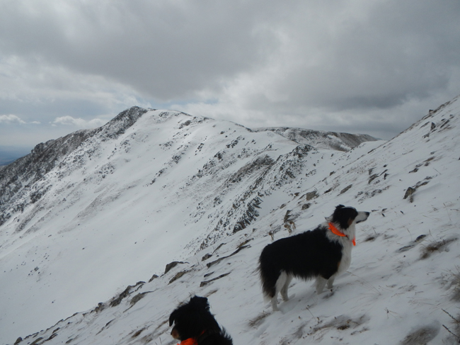
The ridge to Whale Peak’s summit isn’t far but when weather is rolling in, best to make haste and not linger!
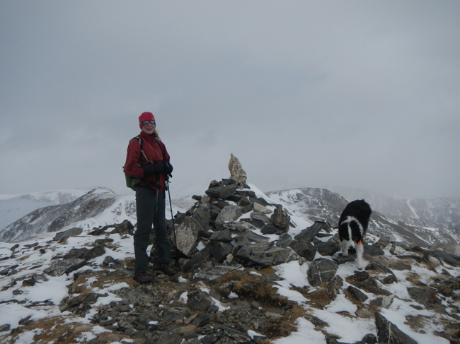
The cold summit of Whale Peak at 13,078 ft.
We descended the same way we came up. If the weather had been less volatile a side trip to Gibson Lake on the way down would have been nice. Once we regained the trail, it was a pleasant hike out. The 4×4 road wasn’t any trouble for my 4Runner, though it was starting to hold snow and ice so access will likely be via snowmobile in a few weeks (this was October 20th, 2013). The storm hit in earnest on the way home and we were glad to be off the peak and en route to warm showers!
One last look at the summit.
Whale Peak was a bit tougher than I anticipated, mostly because of the conditions and my lack of proper gear. In normal hiking season (June – September), Whale Peak is a moderately difficult mountain with some steep off-trail sections but nothing too burly. The wilderness area is gorgeous and despite remnants of past mining operations, Whale Peak is a beautiful Front Range summit that is worth a visit.