Last Updated on August 1, 2023 by James Dziezynski
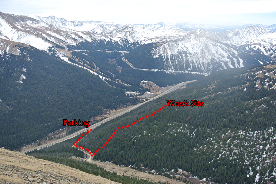
Distance to Plane Wreck: 1.2 miles; 600 vertical feet
Distance to Mount Bethel / Snow Fences: 2.9 miles / 2,280 vertical feet
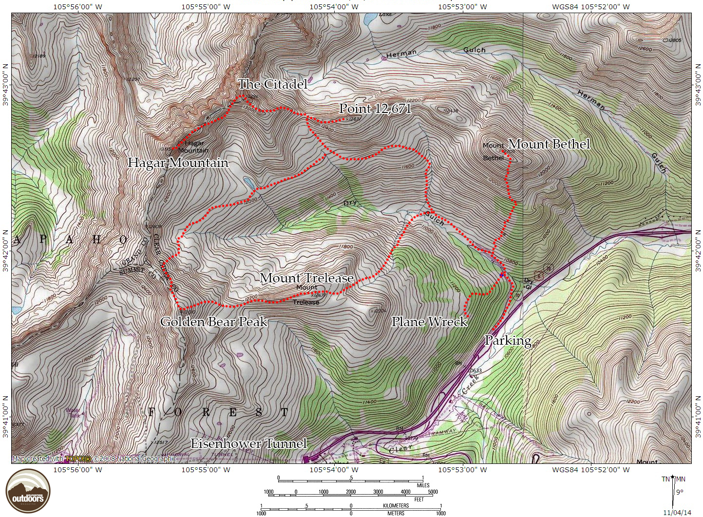
Overview map of the Dry Gulch area. Click for a larger size.
Over the years, I’ve visited quite a few plane wreck sites in Colorado. None may be as fascinating or sobering as the wreckage of the 1970 Wichita State University crash. As the crow flies, the debris field is less 0.2 miles from I-70. The hike along an unmarked (but easy to find) trail is about a mile and the area is still densely littered with twisted metal. Because it is a relatively short outing, it’s worth combining a visit to the wreck with a climb up Mount Bethel, the Citadel, Point 12,671 or any other of the rolling summits in the area of Dry Gulch.
The wreck happened on October 2, 1970. The Martin 4-0-4 carried Wichita State Football team members, their assistants, and a 3-person flight crew. Around 1 pm on a clear day, the pilots got trapped in the box canyon while moving in for a closer view and put the plane down on the side of Mount Trelease. 29 of the 40 people on board were killed in the crash, and two more perished after rescue, making for a total of nine survivors (including the co-pilot who was flying the plane at the time of the crash).
Directions and Parking
Note that before driving to the trailhead for Dry Gulch, you may want to visit the memorial to the victims of the crash. An excellent article on the crash from 5280 can be found here, while Wikipedia’s page on the wreck is quite informative and has good links to detailed reports. This modest memorial is just off the highway past mile marker 217 on westbound I-70, next to the actual creek that runs through Dry Gulch. To check it out (when coming westbound on I-70 from Denver), get ready to pull over when you see the large electronic sign just past mile marker 217. There’s a sandy pull off where you can park.
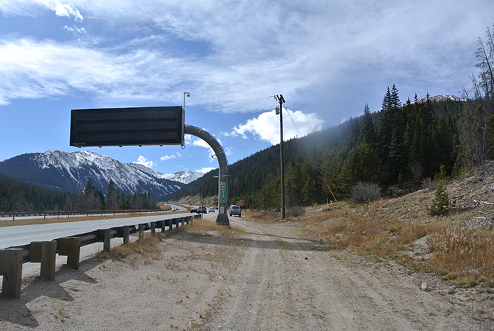
At this large digital sign at mile marker 217, pull off to see the memorial site. There is a little parking area. Note the parking for the trailhead and wreck are further down the road.
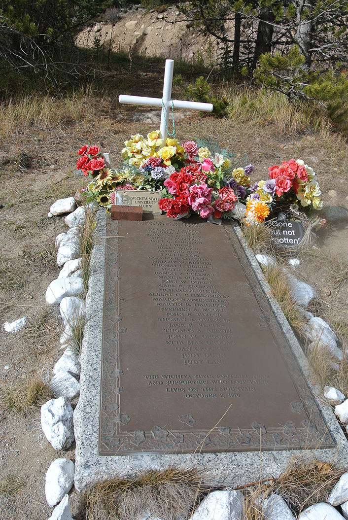
Wichita State University memorial engraved with the names of the crash victims.
To reach the parking area for Dry Gulch, take exit 216 off I-70 westbound(Loveland Pass / Loveland ski area). Before going under the I-70 bridges, turn sharply right onto a flat dirt road. Follow this road a short distance to a metal gate; this is the parking for Dry Gulch. Make sure to pull over far enough to the right so other cars can park and vehicles have access through the gate itself. Please be careful if you have dogs, the highway is only 15 feet away with no fences. Leash ‘em up!
Hiking to the Wichita State Plane Wreck Site
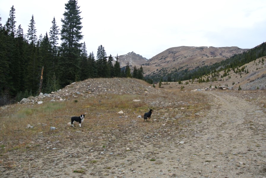
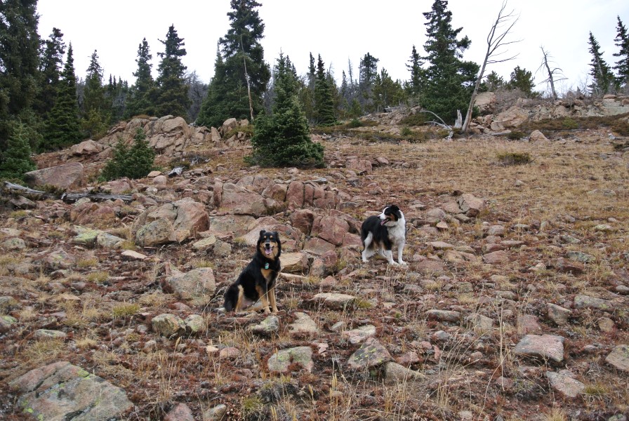
I set off with Richard and my border collies, Fremont and Mystic, for a full day of exploring Dry Gulch. First up was finding the wreckage site. Hopefully, this guide will help those looking for it, as other sites online are a bit spotty with directions. It’s pretty easy to find, and note that you never actually go into Dry Gulch — the wreck area is on the south side of Mount Trelease, facing I-70.
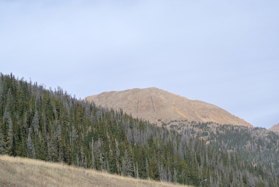
From the gate, head northeast up the road. At 0.4 miles, you’ll come to a flat spot where the road will cross Dry Gulch Creek. There is a large, fenced-in storage area to the right. Just before the fenced area, there is an area on the left side of the road (before the creek) that looks like an old parking area. This is the informal trail to the wreck site. It looks like an old 4×4 or ATV path and goes steeply uphill and as of 2014, it was unmarked.
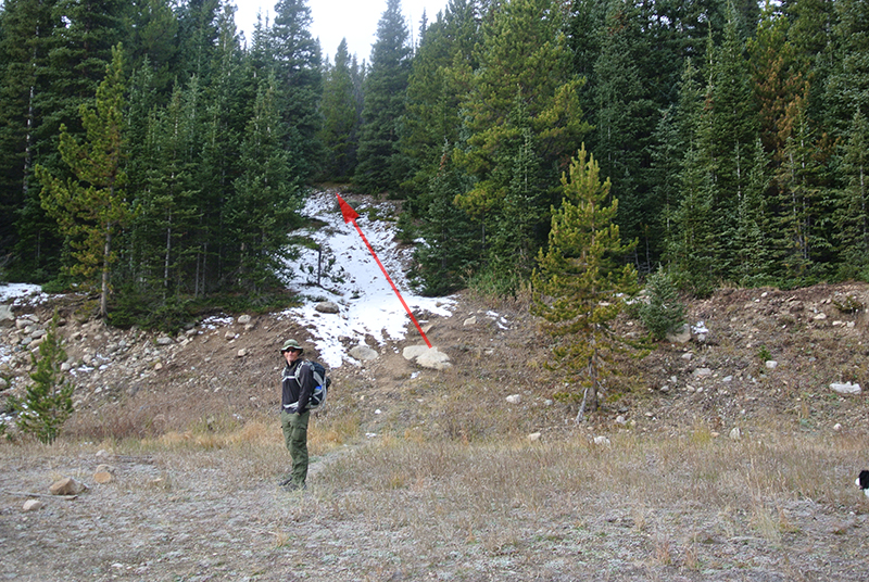
Richard at the turn-off point for the steep trail to the wreck site.
From the start of this trail, you are less than half a mile from the crash site. Be warned, it goes up about 600 vertical feet in a short distance. Stay on this trail as it climbs through the woods. About midway up, there is a cairn that seems to point to a very faint trail. I assume this is a shortcut to wreck, though I would advise skipping it and staying on the main trail. We did see a hiker while we were at the wreck and he came from this trail; it actually goes just below the wreck site. So stay on the steep, more-trodden trail.
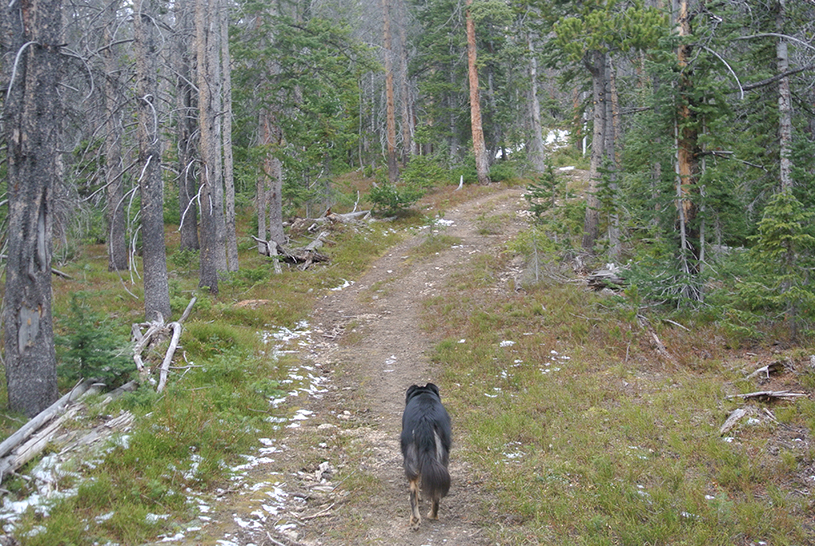
The trail is an old access road that was used to reach the wreckage site. It will be easy to follow until it levels off.
About 0.8 miles in, the steep trail will flatten out just past a bit of a marshy area on your left. At this point, the trail seems to faintly go both left (downhill) and straight through some trees. You’ll want to follow the left path, which is unmarked. There are some white stones and you can consult the photo. Strangely, after the intersection the trail becomes more visible in a short distance. If you overshoot this turn off, just remember to aim left (south) downhill after the steep section of the trail levels off.
Path to the wreck site as seen from Mount Bethel.
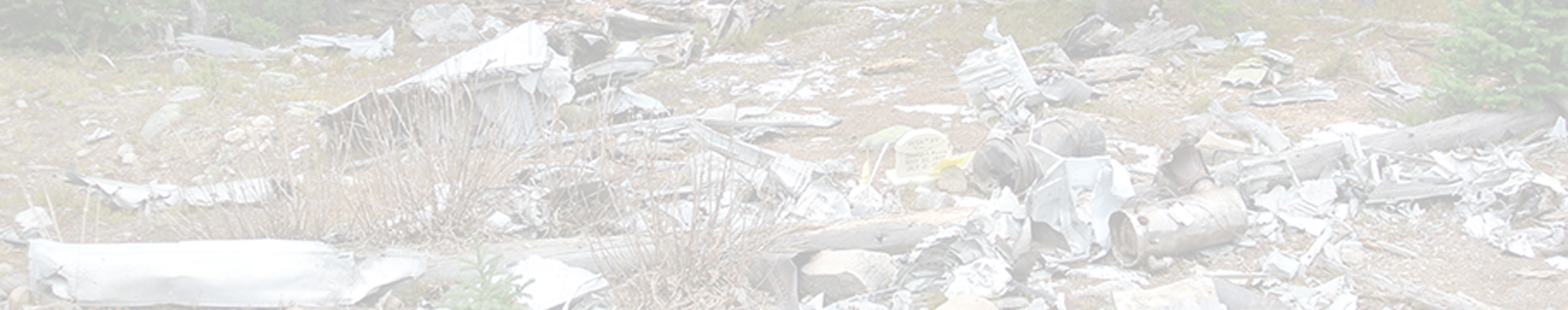
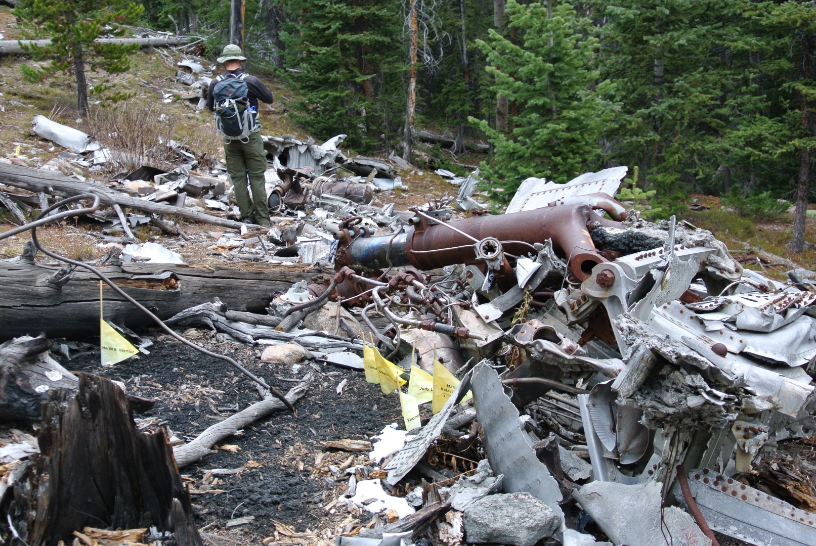
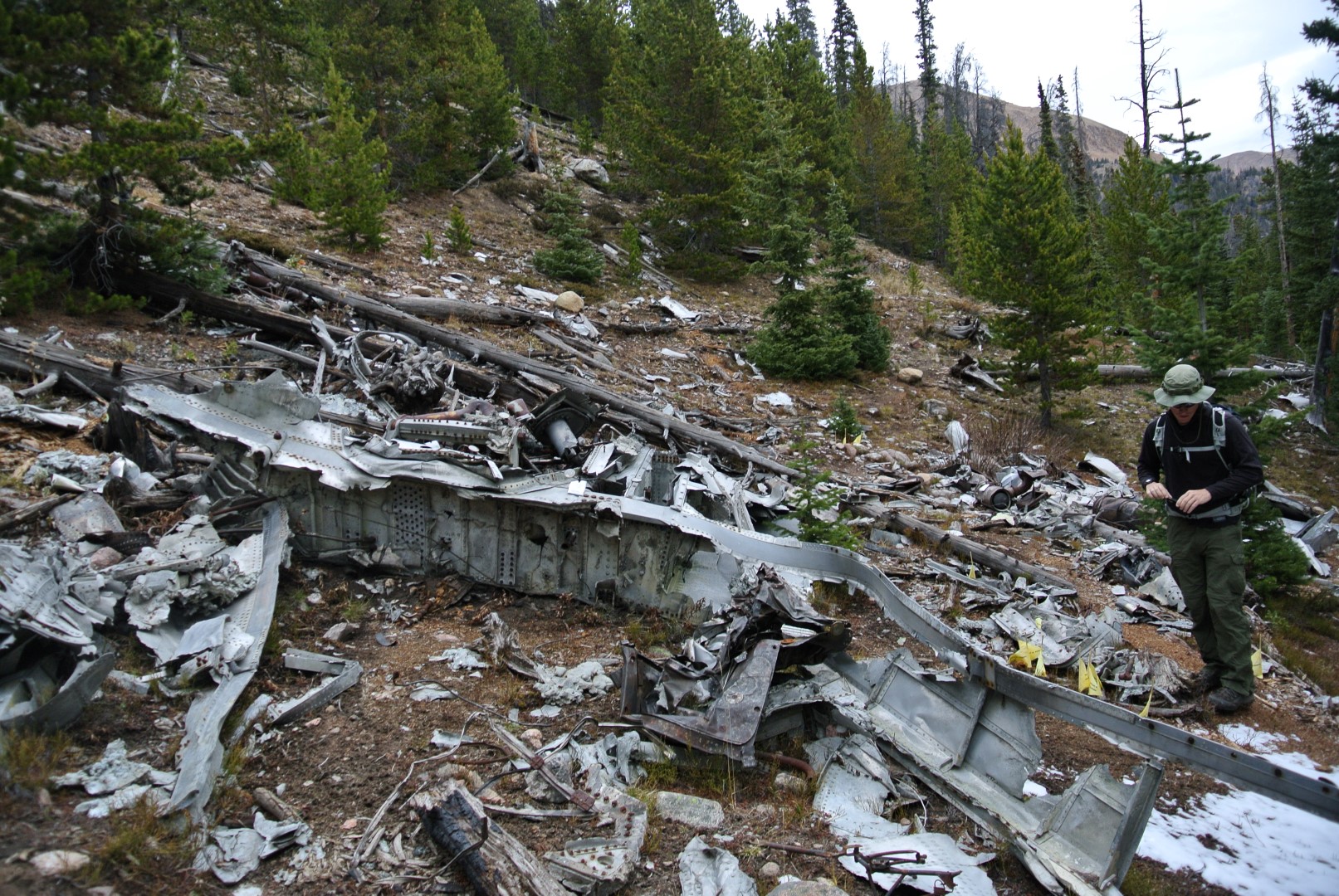
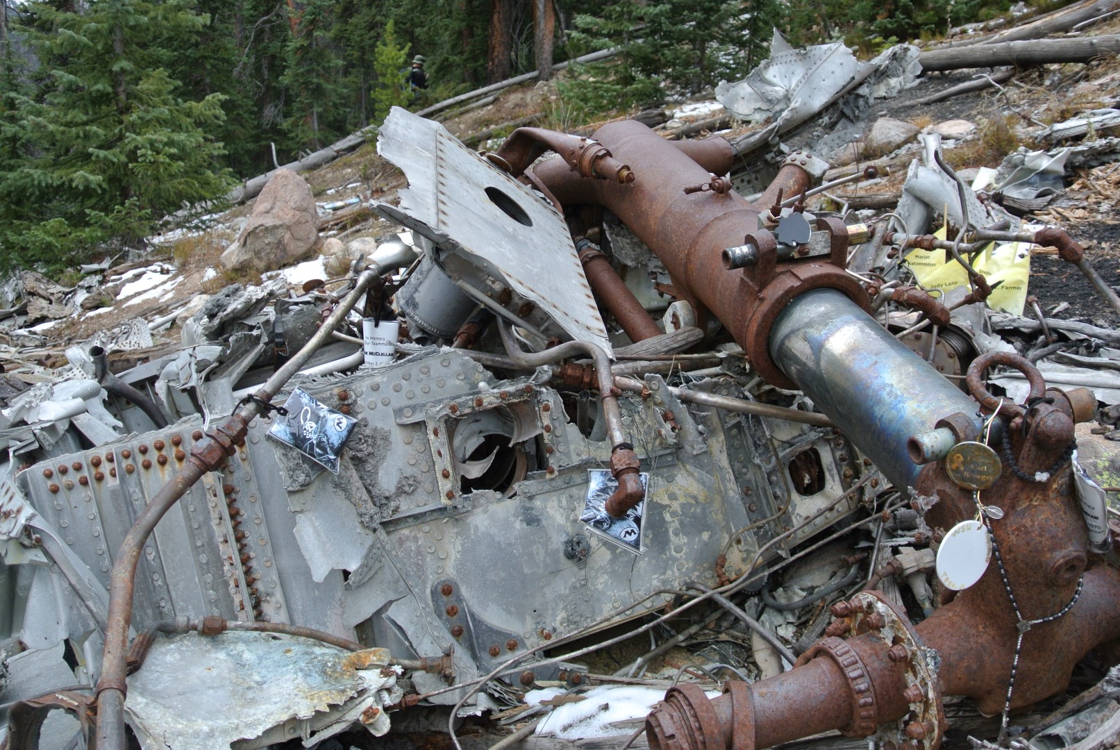
By taking this path, you’ll approach the wreck in a few hundred feet from above. The area is cleared out and at first it’s difficult to tell if you are looking at downed, gray timber or metal. Upon closer inspection, the breadth of the carnage will become apparent. 44 years after the October 2, 1970 crash, gnarled aluminum and crumpled metal gears are eerily unrusted. There are several memorial objects, including a tombstone with the Wichita State football helmet and a few faded flags with the names of the victims.
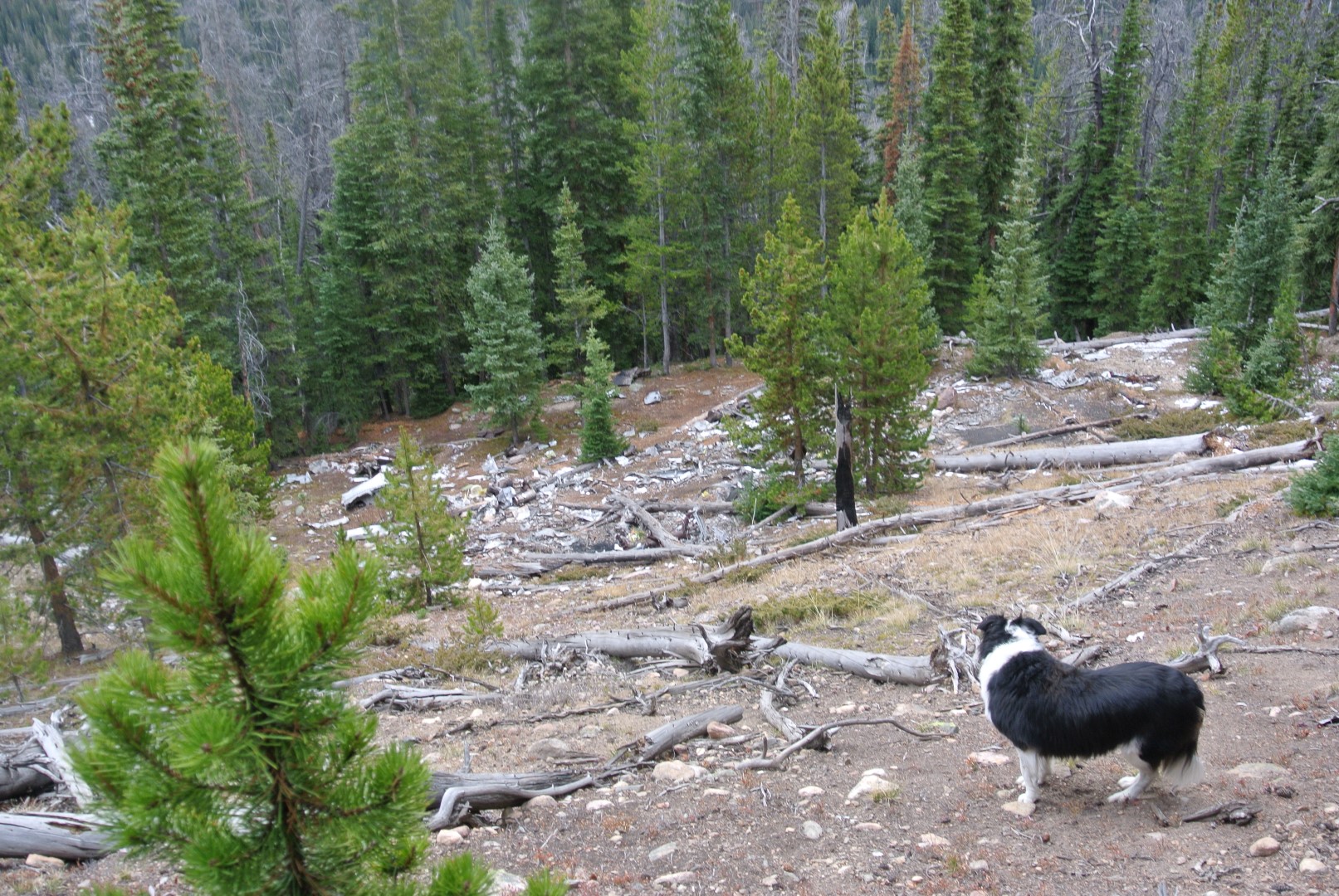
First views of the wreck site.
Some sort of hydraulic component?
More wreckage.
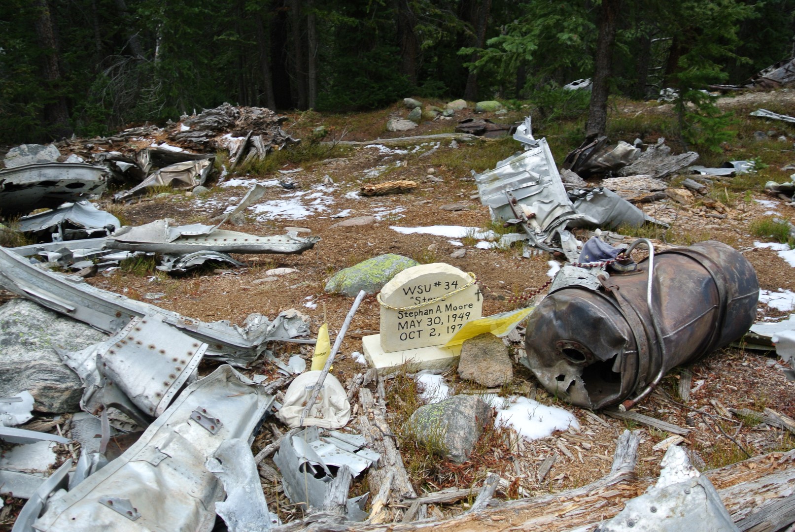
A hand-painted memorial marker within the debris.
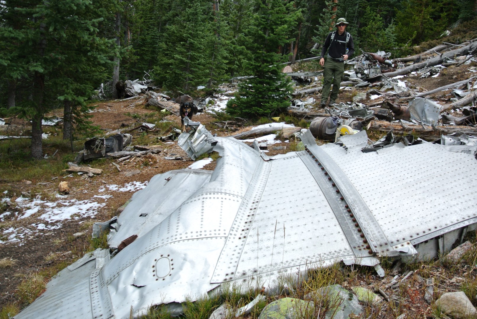
A wing?
Yet more wreckage.
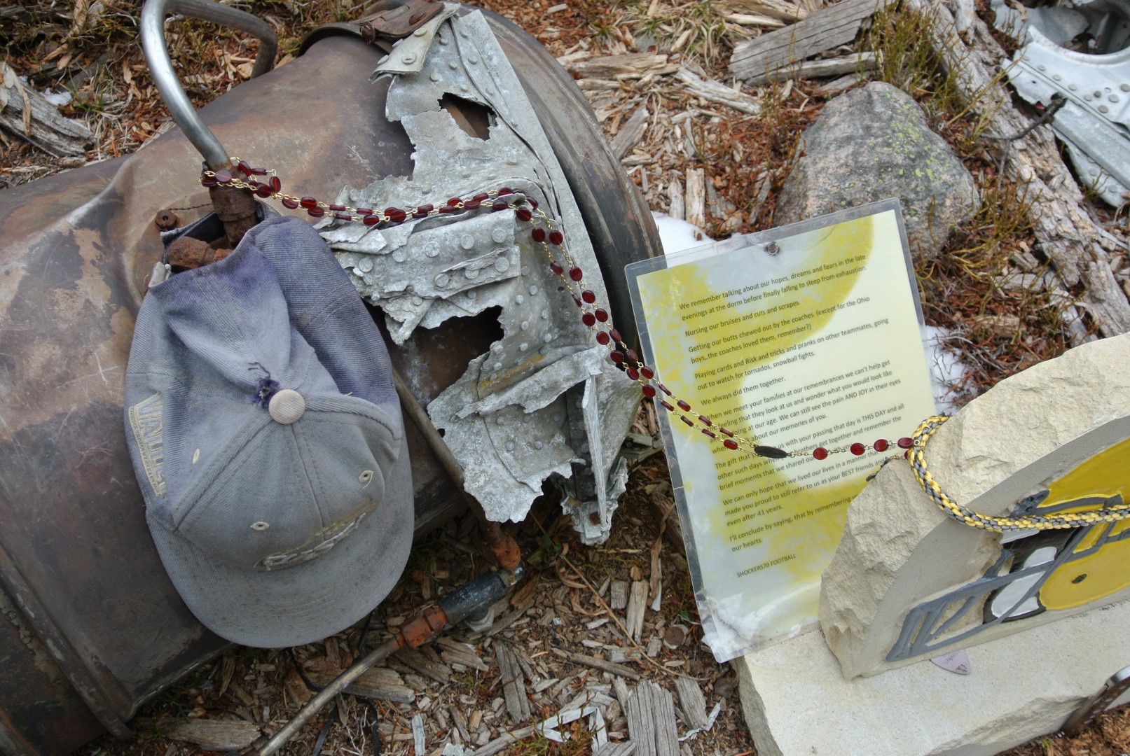
A letter to the victims placed in 2010.
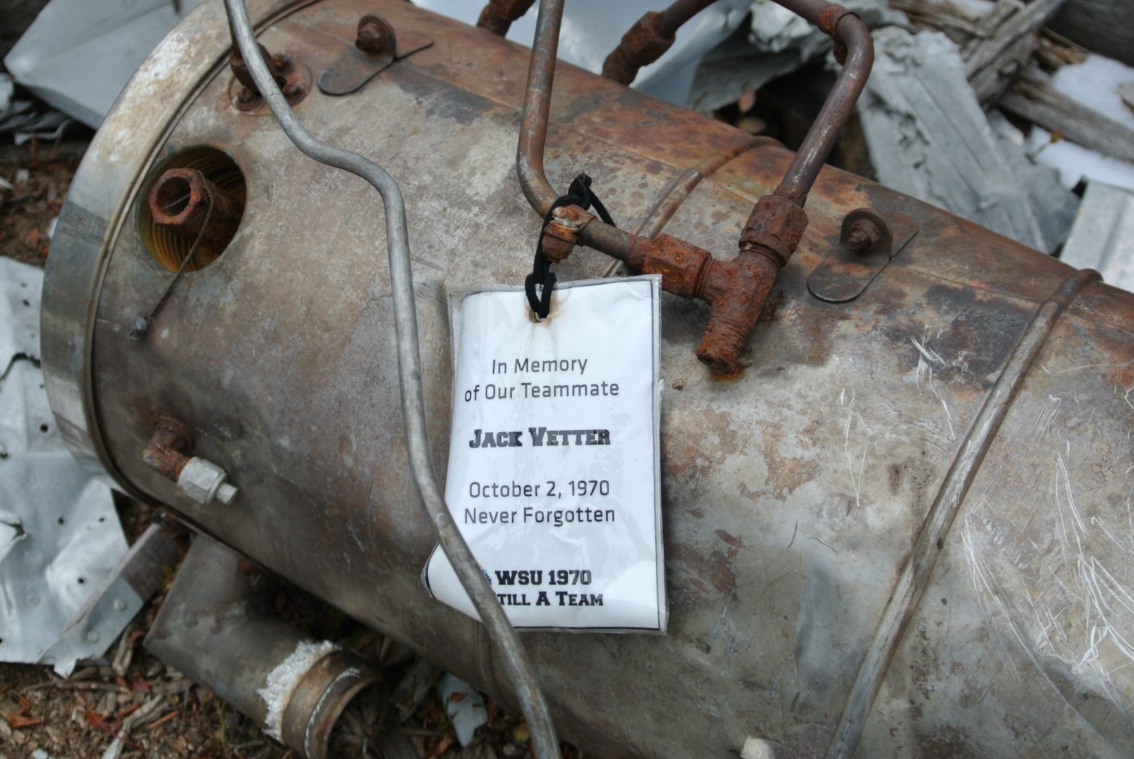
A memorial tag.
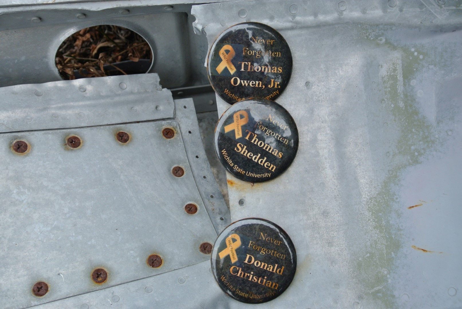
Memorial buttons, slowly starting to rust.
On a personal note, while I find mountain wrecks fascinating, the humanity of the situation is never lost on me. While Richard and I explored the ruins, it was sad to consider how young the men and women on the plane were. Plane crashes are a reality in the mountains and part of the history of our Rocky Mountains; how one chooses to appreciate this fact is up to the individual.
The field of debris extends south (downhill) and off to the east. Most of the metal has been shattered into unrecognizable shapes, though we saw some hydraulics that could have been wheel supports, a cooling unit of some sort and a few painted sections from the shell of the plane.
After paying your respects, return the way you came back to the broad road into Dry Gulch.
Reaching Mount Bethel and the Snow Fences
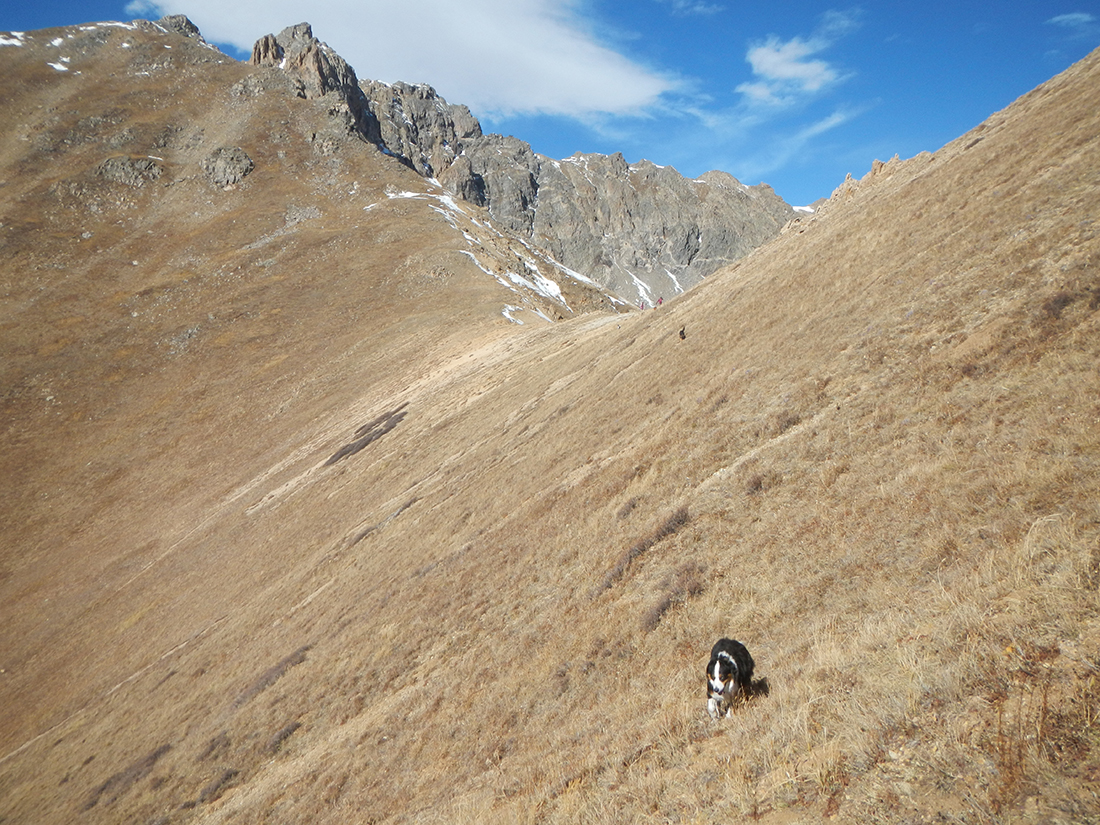
There are no trails to Mount Bethel’s summit; most of the hike up will be above treeline. While it’s perfectly acceptable to head into Dry Gulch a bit farther and head up the saddle between Point 12,671 and Bethel, our crew had a blast simply grinding up the south ridge and slopes. So rather than head into the forest trail that slowly dissolves in the basin, we started up a few hundred feet west of the fenced-in area. The slope is relentlessly steep (poles were my best friend), but going through the foliage was quite fun. Trees and shrubs were gapped out nicely and outside of a few very short sections, the off-trail aspect was steep but easy to navigate. Depending on your off-route planning, it’s about a 3.2-mile round trip up and down Bethel.
The pups get ready to charge up Mount Bethel. We went straight up from the bend in the trail.
The off-trail work in treeline has plenty of open spaces.
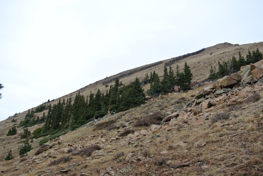
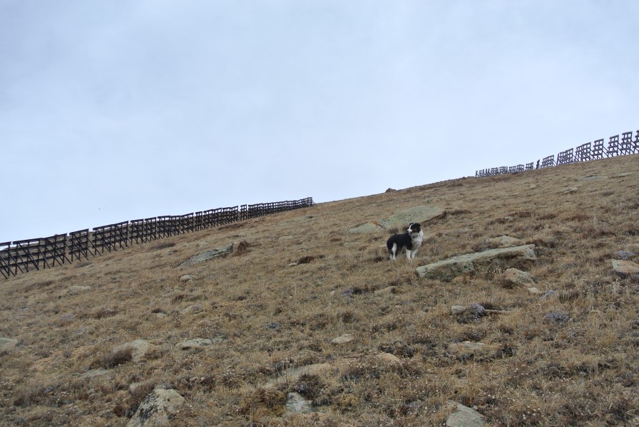
The fences appear above treeline!
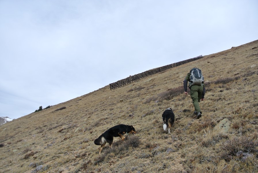
Up we go…
Fremont in the fence zone.
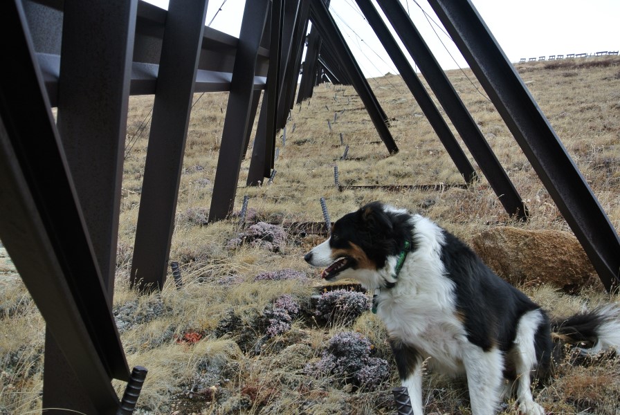
Fremont IN the fence!!
Man, these slopes are STEEP!
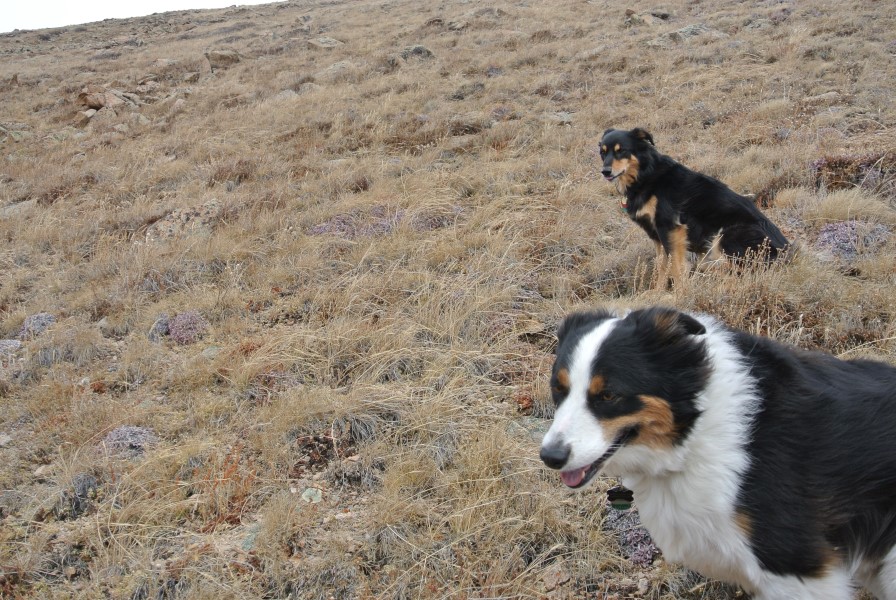
True mountain dogs.
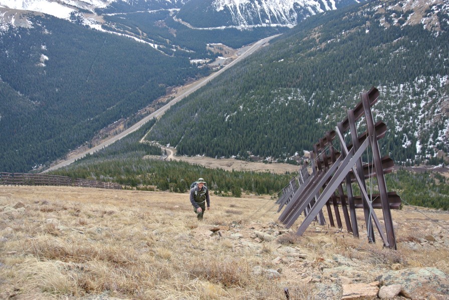
Above treeline, the slopes open up a few hundred feet below the epic snow fences. We were surprised how long they were (around 200 – 250 feet) and how steep the angle was. They are about 10 feet tall and secured into the mountain by crazy strong cables. Though the elevation wasn’t too bad at 12,500 feet, the steepness of the last push to the summit is a real burner. Consider this: from the fenced parking area to the summit of Bethel, it is roughly 2,000 vertical feet in 0.9 miles!
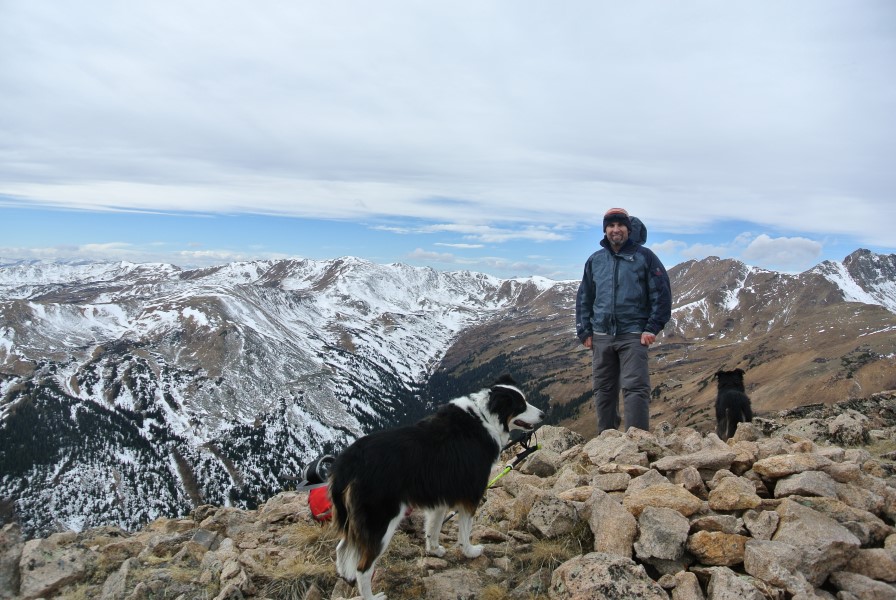
Richard on the summit of Mount Bethel
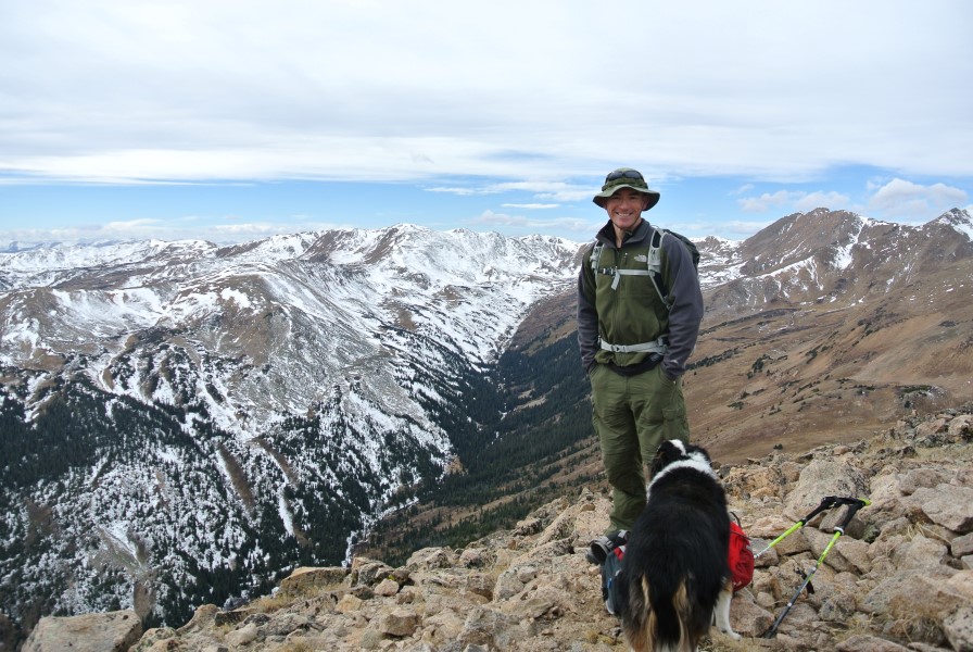
Me n’ the pups on the top of Bethel.
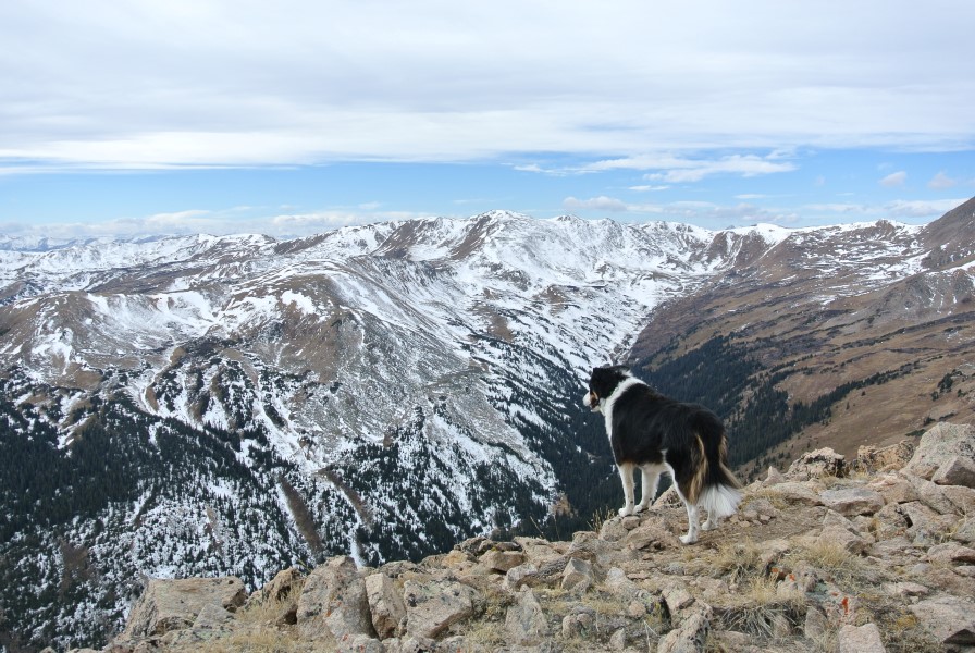
Epic Mystic. Looking west to the Citadel, Hagar Mountain and Pettingell Peak.
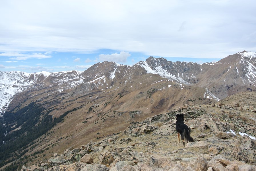
Epic Fremont with Dry Gulch in the distance.
The fences as seen from I-70.
After admiring the views for a while, we opted to head down a bit west of the path we ascended. Despite the steepness, the footing is solid nearly all the way down and the slopes will eventually merge with the Dry Gulch hiking trail. If you aim too far west and miss the trail, no worries — you can always follow the creek east to get back to the open area near the fenced in storage. I opted to leash up my pups so they wouldn’t be off-leash near I-70.
There’s tons of other adventures waiting in Dry Gulch — Mount Trelease, Golden Bear Peak, Hagar Mountain, Pettingell Peak the Citadel and even the terrain of Loveland ski area can all be reached from this area. I wrote up an overview on the area for Elevation Outdoors that gives a good idea of what’s out there. I’m sure I’ll be back there before too long!
The saddle between the Citadel and Pt. 12,671.