Last Updated on October 25, 2023 by James Dziezynski
Finding Connecticut’s highest point can be a tricky task. Rather than courteously locating itself on a mountaintop, the 2,380 ft. high point is hidden in a patch of shrub oak on the south slope of Mount Frissell, a 2,454 ft. mountain whose summit is in Massachusetts. An inconspicuous, green, surveying rod marks the spot where you can stand tall and thump your chest as the elevation king or queen of the Nutmeg State (though no one will see you, because of the shrub oak).
Complicating things is a nearby impostor who has literally carved in stone that it is the “highest ground in Connecticut”. Bear Mountain, at 2,316 ft., can claim to be the highest peak – no other summit is taller. A ten-foot-tall cairn, originally constructed in 1885, has a stone plaque embedded at the base making the declaration, along with the erroneous elevation of 2,354 ft. (still a bit lower than the actual highpoint). It sits a mere 1.3 miles away from the true high point. Bear Mountain sees more traffic thanks to the Appalachian Trail, which traverses the summit of Bear and continues on to Sage’s Ravine, a lovely, shaded, mossy glen just over the border in Massachusetts.
Where to Start Your Mount Frissell Adventure
Thus, Mount Frissell remains elusive but fear not, there are some wonderful trails to help hikers reach both the modest Connecticut state high point as well as the nearby summit of Frissell itself. (For directions to any of the three possible starting points, check out the end of this trip report!)
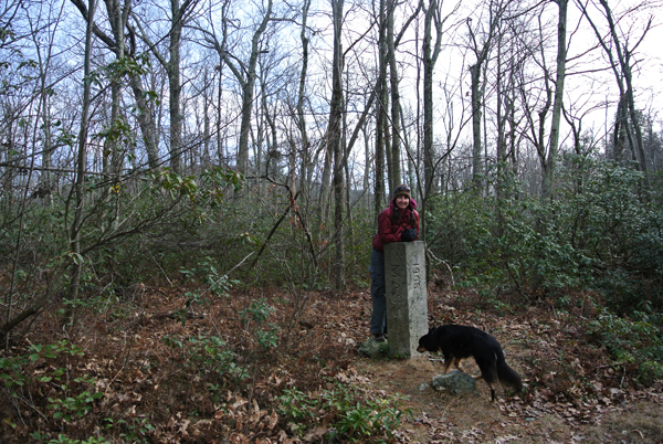
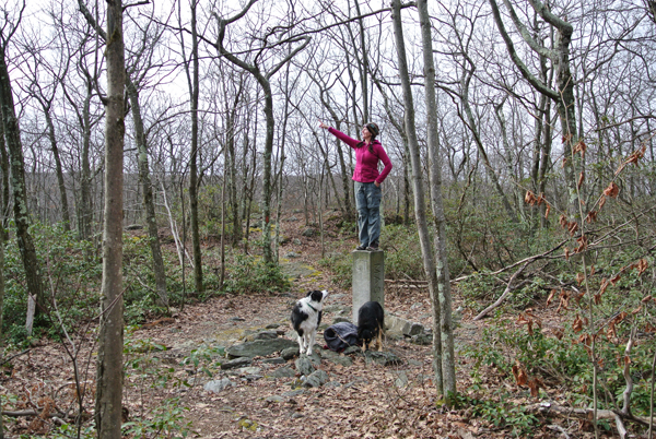
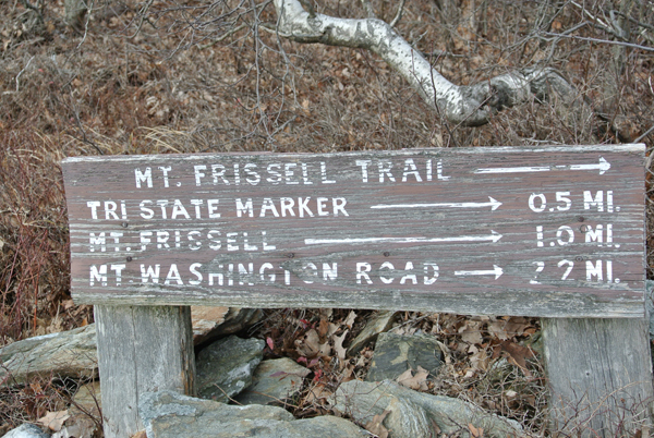
A hike up to Mount Frissell has a lot of fun quirks to it. You can choose to start in either Connecticut or New York and you will inevitably pass through Massachusetts. Less than 0.5 miles from the high point is the tri-state marker where New York, Massachusetts, and Connecticut share a common boundary.
My most recent foray to Mount Frissell began from the Connecticut side, which is just a whisker away from being in Massachusetts. My first time at the peak was from the New York side near the town of Millerton, which is also a great hike (more on that route later on).
I had previously accessed this particular trailhead via Washington, Massachusetts near Bish-Bash Falls and Mount Washington State Park (not THAT Mount Washington! This one is a smaller, more woodsy fellow than its big brother in New Hampshire.) To reach the trailhead this time around, I was accessing a more direct route through Salisbury, Connecticut along Mount Riga Road.
Mount Riga Trailhead
Mount Riga Road is an interesting drive. Starting out as a paved road in Salisbury, it eventually turns into a bumpy dirt road and then veers off to Mount Washington Road. Passenger cars will be fine as long as there isn’t excessive snow and ice. The numerous signs for private property almost make it seem like a private road, but rest assured it is open to the public. Keep in mind this road is not plowed in the winter, so the northern approach along the Massachusetts portion of the Mount Washington Road (or the NY trailhead) is a better choice in snowy conditions.
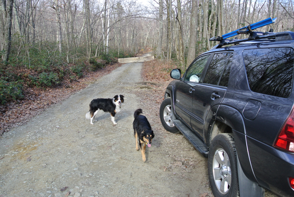
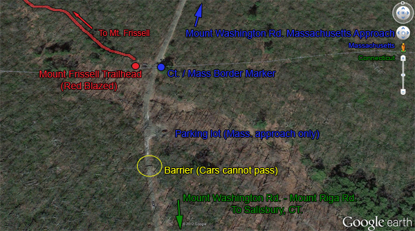
An odd thing happens just before the trailhead. A giant concrete barrier blocks entry to the official trailhead (not to mention a great parking lot). You’ll have to park near the barrier, which doesn’t appear to be going anywhere soon. Luckily, it’s a very short walk over to the Frissell trailhead, about 400 feet on the left (west) side of the dirt road. Hop over the barrier and you’ll see a large parking lot on your right (east); this is not your goal! Almost literally across the street, just past a stone pillar designating the CT/Mass border is the trailhead you want. It has parking for maybe three cars. As of 2012 there are no signs but it is well-maintained and marked with red blazes.
Mount Frissell Hike
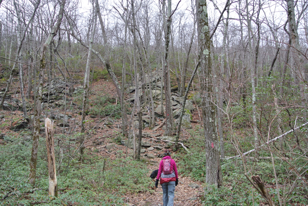
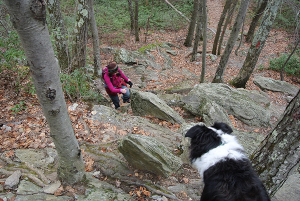
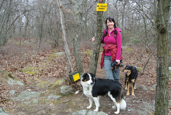
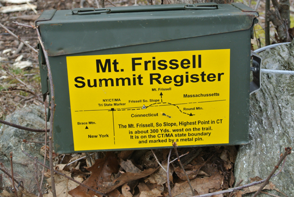
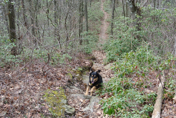
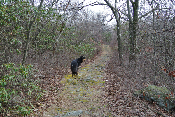
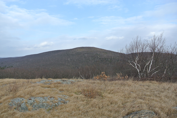
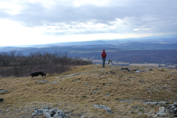
The hike begins through pleasant oak forests at 1,840 ft. and climbs a half-mile to the summit of the blandly but accurately named Round Mountain. Along the way is a fun, steep rock scramble with plenty of handholds and trees to hold onto. The 2,289 ft. summit of Round Mountain has fantastic views, especially to the north. Mount Frissell, in all its humble glory, is a mere half-mile farther to the northwest. After dropping down Round Mountain and bypassing a small pond to the north, a modestly steep climb brings you to the forested summit of Mount Frissell at roughly 1 mile into your hike. The top is well-marked and even has a register to record your daring ascent for posterity.
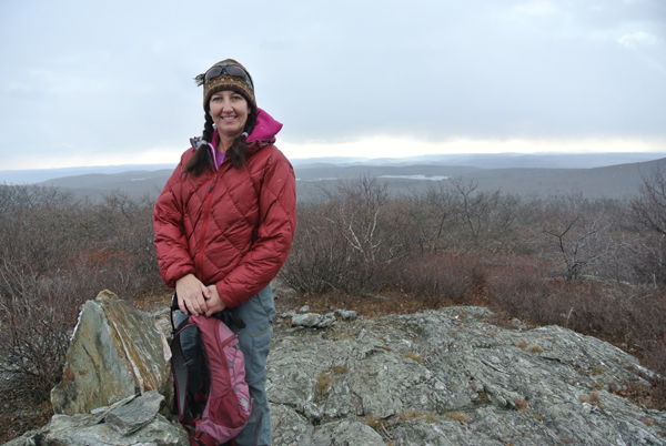
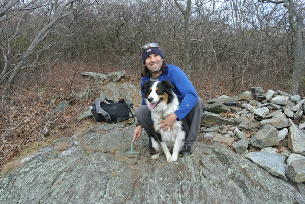
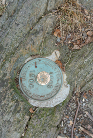
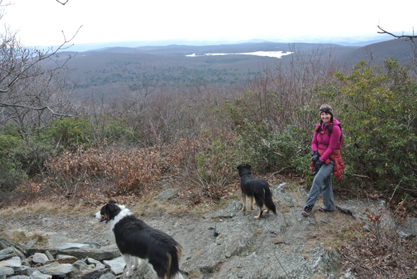
The Connecticut highpoint is a short 300-yard ramble beyond and once again, the views are fantastic, this time to the south. Riga Lake and Grass Pond adorn the gently rolling hills. Finding the actual high point is easy, thanks to a re-route of the trail (a few years back, the highpoint was slightly off the trail and a bit tricky to find). All you have to do is walk and eventually you’ll see a grey, mica-flecked rock with the hallmark green pin poking out – voila, the highest point in Connecticut!
Brace Mountain – The Bonus Peak
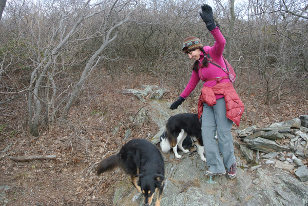
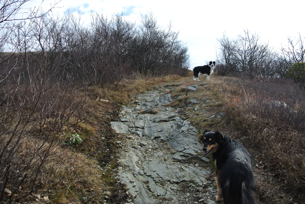
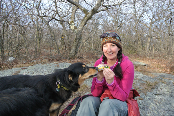
Since it’s only about a 1.2-mile hike to reach the highpoint and heck, you drove all the way out there, let’s keep hiking. A little less than a half-mile from the high point, the trail drops down along a particularly photogenic trail to the fabled tri-state marker. For some odd reason, both dogs we brought chose to do their “business” in Massachusetts. Stay on the red-blazed trail as it intersects the Ashley Hill Trail (which offers a chance to snag another summit in 2,381 ft. Mount Ashley, about a mile away). Follow the red-blazed trail to the end less than 0.5 miles away.
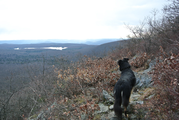
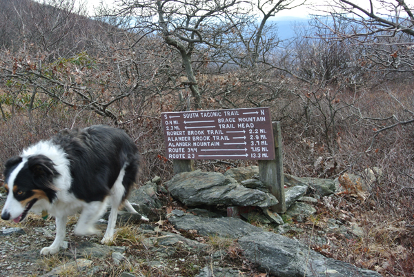
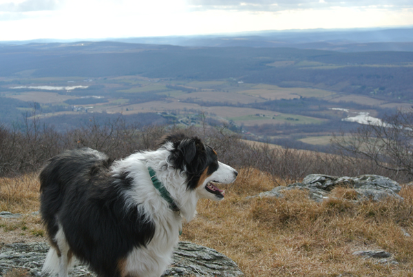
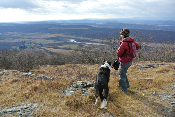
When the red-blazed trail terminates, you’ll be 2.2 miles from your starting trailhead, as indicated by a collection of trail signs. The white-blazed trail running north/south at the terminus of the Mount Frissell Trail is the South Taconic Trail. The views here to the west may be the very best of the hike. You’ll be about 1,200 feet above the bucolic Hudson Valley with gorgeous views of the Catskill Mountains to the west.
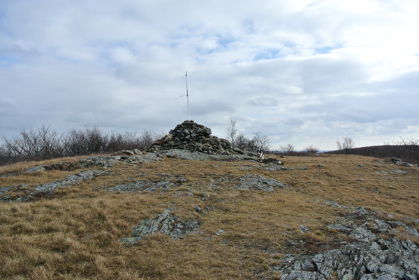
I highly recommend the short, 0.4 mile-long jaunt over to 2,311 ft. Brace Mountain. This is a short, nearly flat hike that follows a masterfully designed tunnel of trees, popping out to a clearing where an enormous rock pile heralds the summit of Brace Mountain (itself the high point of Dutchess County, NY). Again, the views are fantastic looking across the Hudson Valley to the Helderberg Escarpment to the north and the Catskill Mountains to the west. A long pole with a fatigued wind sock juts from the summit as an aide to the hang gliders and paragliders who use Brace as a launching point.
Wrapping Up the Adventure
At this point, we opted to turn around and retrace our steps for a great day hike of about 5.5 miles total in about 3 hours. If you’re hoping for a longer day, a side trek to 2,239 ft. Alander Mountain is roughly 3.7 miles from the Frissell / South Taconic Trail Junction. If you do this route, complete with the detour to Brace and Alander, it’s about 12.6 miles total – a robust hike for an all-day outing but none too hard for fit hikers.

As a note, the western New York trail access starts from Quarry Hill Road and has a very steep climb of roughly 1,300 vertical (big stuff for southern New England!) from the trailhead to the summit of Brace Mountain, 1.9 miles in. Along the way, you’ll bypass a large waterfall that seems to have ice climbing potential when it freezes over.
Closing thoughts: the tri-state area has some of the most beautiful hikes in all of New England and the most spacious view in all of southern New England. The Appalachian Trail is nearby but the wonderful little South Taconic Trail, at 15.7 miles total, shouldn’t be overlooked. Hiking is top-notch year-round, though winter access takes a little planning in advance. Chances are you won’t see many other hikers.
Even though I now make Colorado home, I still have fond memories of my home state’s little high point. It’s as quiet and unassuming as the sleepy towns that surround it – but it does appreciate the occasional visitor.